The Arlberg Trail
The Arlberg Trail

The Arlberg Trail

In 3 different difficulty levels

LEVEL
2
DISTANCE
52 km
DURATION
4 days | 3 nights
PERIOD
Jul Aug Sep
PRICE FROM
€ 595
CO2e FOOTPRINT
73 Kg/person
  1. Austria
  2.  | 
  3. Self-Guided
  4.  | 
  5. Tourcode 2ATINN50

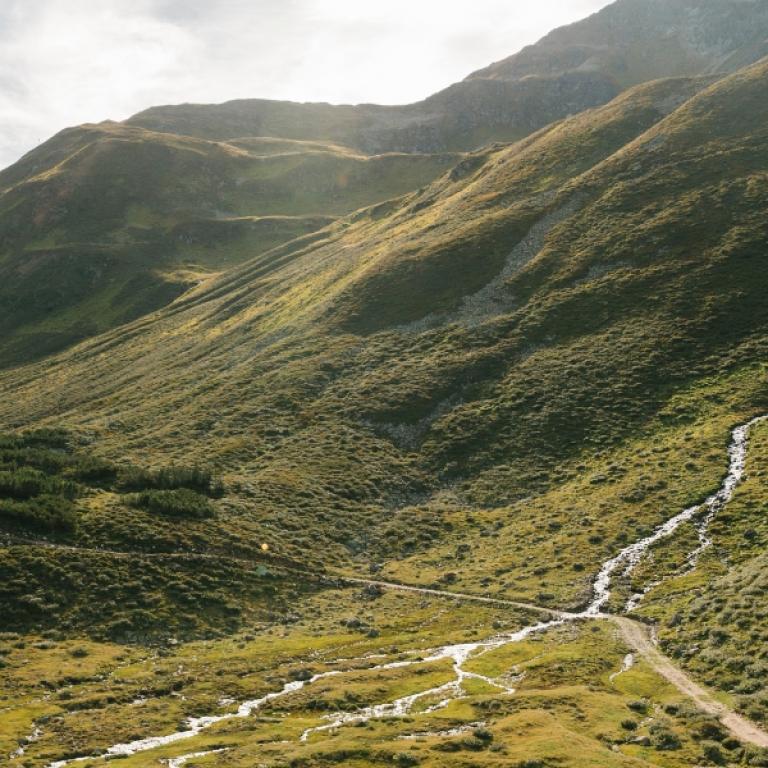
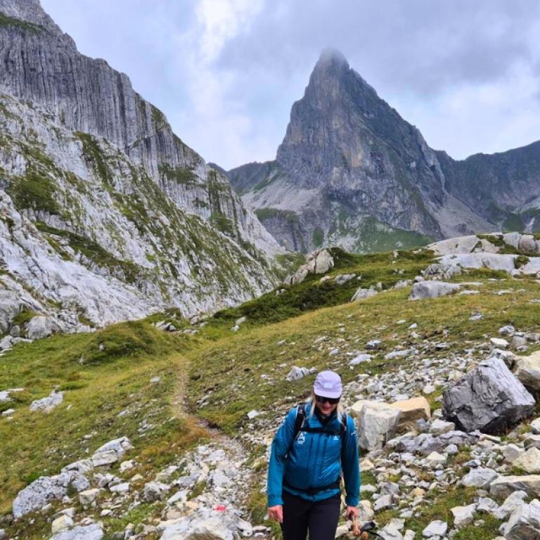
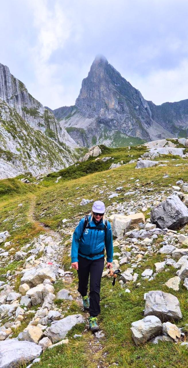
Known as the “cradle of alpine skiing,” the Arlberg is just as magical in summer—though still a well-kept secret. Here, the Verwall, Lechquellen, and Lechtal Alps meet, creating a patchwork of alpine meadows, colorful rocks, glistening lakes, and shady valleys.

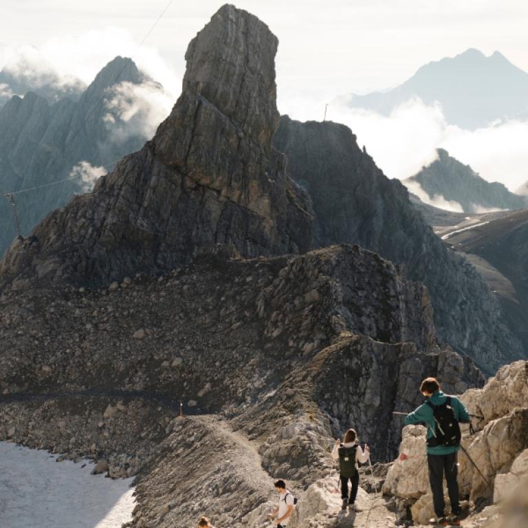
The Arlberg Trail links all five villages—Lech, Zürs, Stuben, St. Anton, and St. Christoph—into one circular route. In three stages, with cable cars easing the way, you’ll cover 40 km of breathtaking trails. Each day offers the choice between the original route or gentler alternatives, with luggage transfer included so you walk free and light. Evenings are spent in carefully selected hotels in St.

read more >>
Highlights

  • Hike the sporty challenge of the Arlberg Trail in spectacular alpine scenary
  • Discover the Monzabonsee in the Lechtal Alps
  • Enjoy the spectacular summit panorama from the Galzig with Pateriol and Kuchenspitze 
  • Taste Vorarlberg cheese specialties when stopping at the Kaltenberghütte 
  • Look forward to comfortable hotels and a unique mountain experience 


Itinerary

Day 1

Arrive in St. Anton am Arlberg

Arrive in St. Anton am Arlberg

The Arlberg Trail adventure begins in St. Anton am Arlberg.

Over the next three days, you will traverse the impressive high mountain region around the Arlberg Pass. It’s best to arrive a bit earlier in the day to explore the famous alpine village and enjoy the amenities of your hotel. 

Day 2

Walk from St. Anton to Stuben

Walk from St. Anton to Stuben

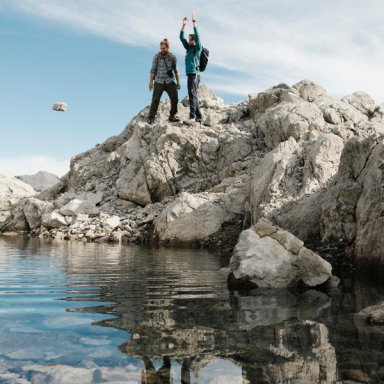
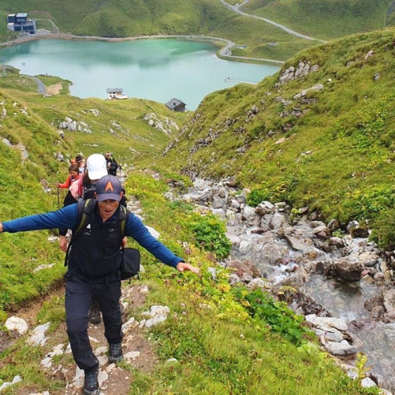
The tour begins with the Galzigbahn cable car, which takes you up to 2,082 meters. From the mountain station, the trail leads through varied alpine landscapes. The Paul-Bantlin path follows along the Albonaseen lakes, whose crystal-clear waters and surrounding mountain scenery make for a delightful stop. The trail continues to the Kaltenbergerhütte, ideal for a break. The descent goes through meadows and moors down into the valley, past the Stubener Lake, before the tour ends in Stuben am Arlberg. 

Distance: 13,5 km;

Elevation Gain: +428/-1098 m

You can walk a more CHALLENGING version (original route)

Distance: 16,3;

Elevation Gain: +714/-1367 m

You can walk an EASIER version

Distance: 11,6 km;

Elevation Gain: +561/-466 m

Day 3

Walk from Stuben to Lech

Walk from Stuben to Lech

From Stuben, the gateway to the Arlberg, the tour follows a forest path towards the Flexen valley. Then the trail climbs briefly but steeply on the Franz-Josef path towards the Flexen Pass. Along the hike, you’ll repeatedly enjoy impressive views of Stuben, located at 1,407 meters above sea level. Soon you reach the European watershed, marking the boundary between Northern and Southern Europe. From here, the path gently descends towards Zürs until you reach the Seekopfbahn cable car. This takes you comfortably up to 2,212 meters. At the top, you can enjoy not only the breathtaking view of Zürsersee but also the option to refresh yourself at the Seekopf Panorama Restaurant. From there, you hike downhill over the Wiesele until you finally reach the charming town of Lech am Arlberg, where the tour ends. 

Distance: 12 km

Elevation Gain: +388/-880 m

You can walk a more CHALLENGING version (original route)

Distance: 13,8 km

Elevation Gain: +682/-1158 m

You can walk an EASIER version

Distance: 11,1 km; 

Elevation Gain: +447/-404 m

Day 4

Walk from Lech to St. Anton

Walk from Lech to St. Anton

From Lech, take the regular bus to the Trittkopfbahn cable car in Zürs. From there, the trail follows along the Zürsbach stream and past the Flexen Pass on a familiar section of the route. Just before the Flexen gallery, follow the Gafri path past the Hölltobel towards Alpe Rauz. Here begins the ascent to the Ulmer Hütte at 2,255 meters, which invites you to take a break with its magnificent views of the surrounding mountains. From the hut, the trail leads past the Arlensattel Speichersee, downhill to the mountain station of the Galzigbahn cable car, which will comfortably bring you back to St. Anton. Your luggage will be delivered back to the hotel in St. Anton where you first stayed at the start of the Arlberg Trail.

Distance: 11 km

Elevation Gain: +850/-480 m

You can walk a more CHALLENGING version (original route)

Distance: 14 km

Elevation Gain: +1200/-900m

You can walk an EASIER version

Distance: 6,4 km; 

Elevation Gain: +74/-693m

Details

Is this for me?


Each day on the trail, you can choose between three different hiking options—ranging from easier walks to more challenging routes—so you can tailor the journey to your own level of fitness. A moderate level of fitness is recommended, but with alternatives available every day, the tour remains accessible for anyone in good health who enjoys walking.

Included


What is included

  • 3 Nights in selected ***/**** hotels with breakfast
  • Luggage transportation from hotel to hotel (1 item per person, max 20 kilos)
  • Maps and detailed description of the itinerary
  • Medical and luggage travel insurance
  • 24h phone assistance

What is not included 

  • Transfers to the starting location and from the arriving location of the tour
  • Lunches and dinners, if not otherwise stated
  • Visits and entrance fees - tips
  • Arlberg Trail Ticket (includes all necessary cable car rides, €72) 
  • Personal expense
  • Possible sojourn taxes
  • Everything that is not mentioned in the "What is included" section.

Optional Services

These services can be added to the ones included in the base price of the tour:

  • Single room supplement
  • Cancellation insurance

Accommodation


For our trips, we always choose accommodation with private rooms and private bathrooms. In rare cases, shared accommodations or shared bathrooms may be provided, so we recommend carefully checking the inclusions section to understand the type of accommodation included in the trip you are interested in.  

We place great importance on the choice of accommodations and select hotels with care and attention. We understand how essential it is to rest well after a day of walking. We always prefer cozy and characteristic establishments, preferably family-run, that fully embody the spirit of the place and offer hospitality with courtesy and comfort.  

Where, due to the nature of the route, accommodation options are limited, we choose the one that best aligns with our standards.


Hotel die Arlbergerin ⋆⋆⋆⋆ or similar, Anton am Arlberg

Hotel Haus Flexen ⋆⋆⋆ or similar, Stuben am Arlberg

Hotel Roggal ⋆⋆⋆⋆ or similar, Lech am Arlberg 


When to travel


The Arlberg mountains are at their most inviting in summer and early autumn, when meadows are in bloom, lakes sparkle in the sun, and the high valleys offer fresh, cool air. From late June to September, the weather is generally mild and clear—perfect for hiking. July and August bring alpine flowers in full color, while September adds a golden touch to the landscapes and quieter trails. Even in summer, temperatures in the higher valleys can be fresh, so it’s best to pack layers to enjoy the full beauty of the Alps in comfort.


What to bring


Clothing and other items
You will need your regular walking/cycling gear, including some sort of reflective garment. For the evenings, smart outdoor style trousers (or shorts) are invaluable, as are quick-dry t-shirts. These can be washed easily and will dry overnight and still look good for sightseeing or having a drink in town.

Take as little as possible to avoid potentially lugging a heavy suitcase up three flights of stairs at the end of the day. Please be aware that laundromats (“Laverie”) are not common in rural areas, so plan to do handwashing of small items.

Lightweight walking shoes/ trainers
For wearing around towns & villages. They can also be a back-up pair.

Socks & underwear
Take only good quality socks with quick-dry and insulating qualities. Road test them before you go on the trip. Take a suitable quantity of underwear as washing facilities are limited.

Warm jacket, hat, gloves
Bring a fleece, Polartec or warm layers for the evenings especially in spring or autumn; be sure it is totally suitable for your needs.
A fleece jacket which blocks the wind (Wind-stopper) is the most preferable. In the summer months a lightweight jacket is suitable for evenings.
If you are cycling/walking in mountainous or coastal areas, even in the height of summer, the weather can change very quickly and unexpectedly and you should be prepared for fog, mist, rain, snow or hail at any time. Always take an extra layer with you, as well as a warm hat and gloves.

Waterproof jacket & trousers
If you are caught in heavy rain, with good waterproof clothing you should remain dry. Remember that most garments will lose their properties over time. Few will remain waterproof for more than five years and many deteriorate in three years or less. We recommend a rain jacket with a good hood and collar and waterproof or thermal walking/cycling trousers or tights.

Dress code
In general, you should wear suitable clothing when entering a church (in many places, it is considered unacceptable to go inside wearing shorts or a tank-top). We suggest that women carry a shawl to cover up bear shoulders or low-cut tops. It also comes in handy when your shoulders get sunburned!

It is considered inappropriate for men to go without a shirt / T-shirt (other than at the beach).

Trekking poles (adjustable)
Highly recommended. A pair works best, depending on what you are comfortable with. If you suffer from back or knee pain this should be considered essential. Remember to practise walking with your pole(s) on different types of terrain in the months preceding your trip.

Walking boots
The importance of good footwear cannot be stressed enough. Your boots should be sturdy and of good enough quality to handle all types of terrain. Lightweight boots, (cordura/leather boots) which have Gore-Tex or sympatex water-proofing are most suitable for this trip. They should provide good ankle protection and be well broken in. Waxing leather boots regularly prolongs their life.

Walking tops & trousers
We recommend walking trousers and shorts and quick-dry wicking t-shirts. These can be washed easily and will dry overnight and still look good for sightseeing or having a drink in town. Wicking T-shirts are fast drying, keep moisture away from your skin and are available at outdoor stores. You should also bring one pair of loose-fitting trousers to wear in cities and for evenings out, etc. Shorts or zip-off trousers are useful in warmer weather.

Headlamp / flashlight

Sun protection
Hat, sunglasses and sunscreen

Water bottle
With at least 1-liter capacity 

Additionally Recommended Equipment 
Rain cover for the backpack
Swimwear for sauna and wellness area 
Camera equipment, mobile phone, charging cables 

Practical info

How to arrive


How to Get There & How to Leave
Reaching the Arlberg is simple and scenic. The closest airports are Innsbruck (Austria, about 100 km away) and Zurich (Switzerland, about 200 km away). From both, regular train connections bring you straight to St. Anton am Arlberg, the gateway to your adventure.

Trains in Austria and Switzerland are reliable, comfortable, and a beautiful way to ease into the alpine atmosphere—you’ll find full schedules and tickets at www.oebb.at and www.bahn.de. Once you arrive in St. Anton, most hotels are just a short walk from the station.

At the end of your journey, you’ll return to St. Anton, making it just as easy to continue your travels or head back to the airport. Whether you extend your stay in the Alps or catch your train home, the Arlberg is wonderfully connected to the wider wor


Mobile App


Use the SloWays APP for iOS and Android smart phones in combination with the written documentation provided.

The App has the detailed tracks and maps that you can use offline and without roaming. Thanks to the phone’s internal GPS, you can check your exact position on the map, so you always know exactly where you are. It also helps you self-navigate you way while travelling. More information on how to use the App inside the roadbook documents.

The navigation features include:

  • Offline navigation. Mobile data not required after initial download
  • Accurate GPS tracks
  • Autorotation of the maps
  • Daily route summary and elevation chart
  • Panorama of the track and at street level
  • Alarm and vibration that alerts you in case you go off track.
  • Emergency SMS button with position coordinates
  • Possibility to record and take georeferenced photos of problems on route alerting fellow travelers
  • Hotel information
  • Points of interest along the way
  • Historical background

Wanderlust Nominee Best Specialist Tour Operator 2025
Wanderlust
Nominee Best Specialist Tour Operator 2023
Change currency:

We accept:

VISA MASTERCARD

We accept:

VISA
MASTERCARD
FTO ATTA member
RePower Travelife
ISO Partner ISO Partner
FTO ATTA member RePower Travelife ISO Partner ISO Partner

Touroperating
S-Cape Countryside Travels srl
Borgo Allegri 16R
50122 Firenze FI
P. IVA 05227330486

 
© 2025 SloWays. All rights reserved.
Touroperating S-Cape Countryside Travels srl Borgo Allegri 16R 50122 Firenze FI, Italy
VAT Nr 05227330486
extraSmallDevice
smallDevice
mediumDevice
largeDevice
largeDevice
largeDevice