walking the heart of the dolomites in val gardena

Walking in the heart of Dolomites

LEVEL
3
DISTANCE
70 km
DURATION
8 days | 7 nights
PERIOD
Jun Jul Aug Sep
PRICE FROM
€ 866
CO2e FOOTPRINT
142 Kg/person
  1. Italy
  2.  | 
  3. Self-Guided
  4.  | 
  5. Tourcode ITSW280

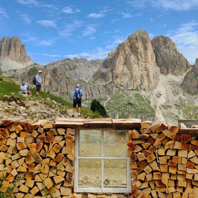
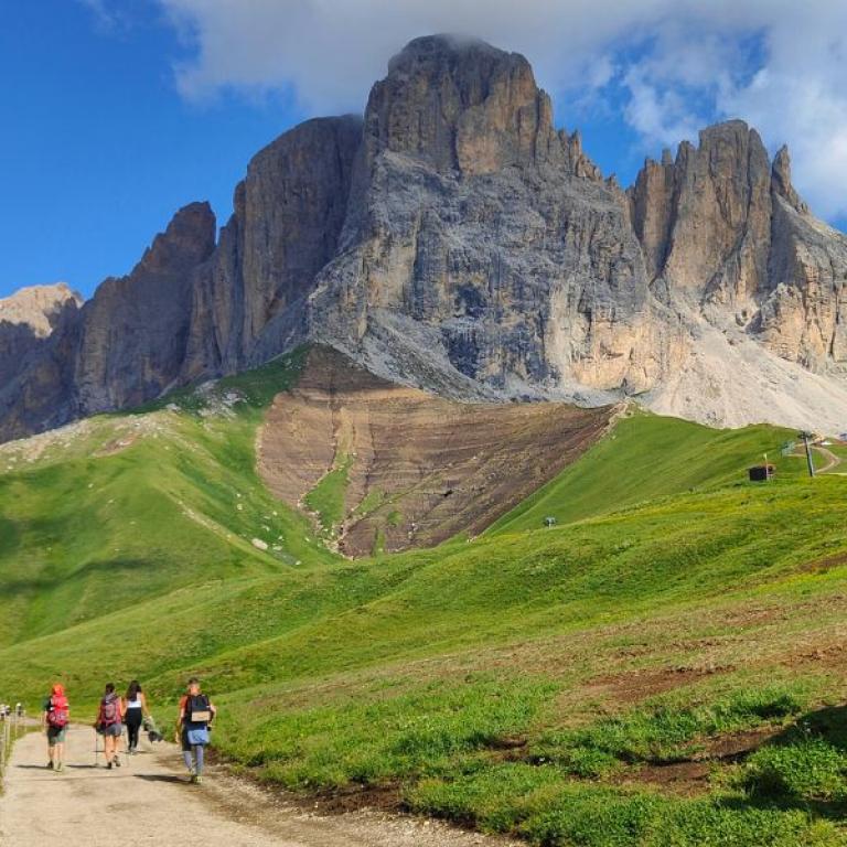
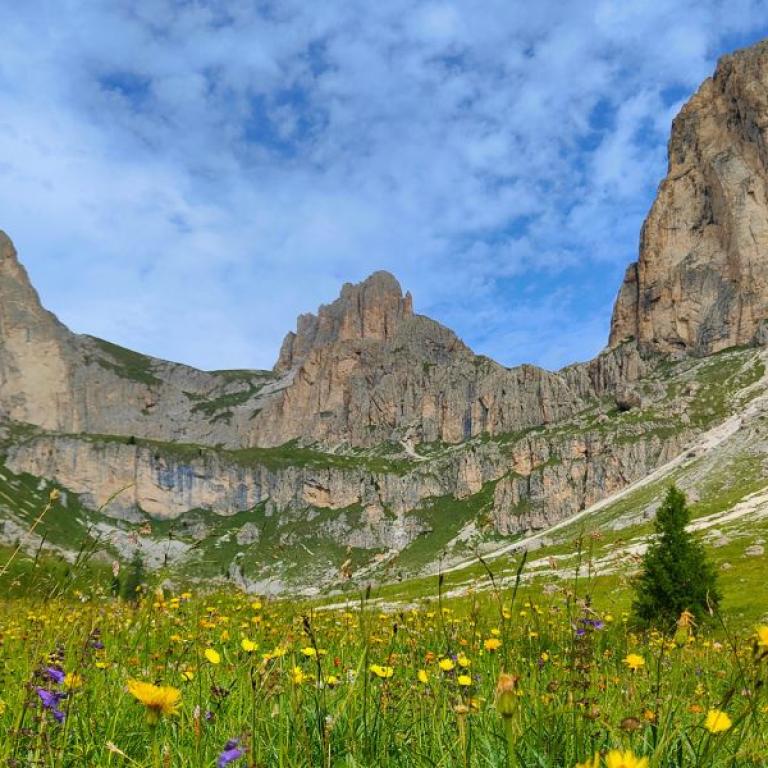
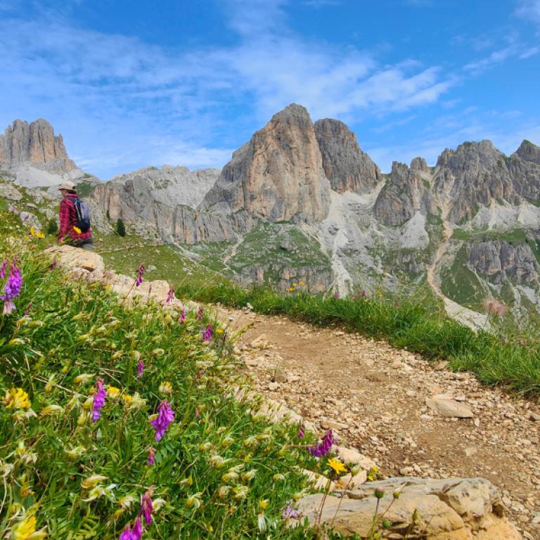
There is a scenario in which the entire world envies us, where nature has created such evocative images that they seem only a fantasy: but here they are all around you, as you walk along paths at high altitude, surrounded by enormous meadows and pine woods scented with flowers, and accompanied by the whistle of marmots chasing each other. 

There are mountains everywhere, filling the horizon and defying the sky, creating natural amphitheaters and rocky canyons that you thought only existed in Patagonia or the American West.

UNESCO has recognized Val di Fassa as a World Heritage Site, and the landscape in which you are immersed deserves such recognition. It is Canazei that will serve as your base for exploring the most beautiful routes in the region - and that is what you will do every day.
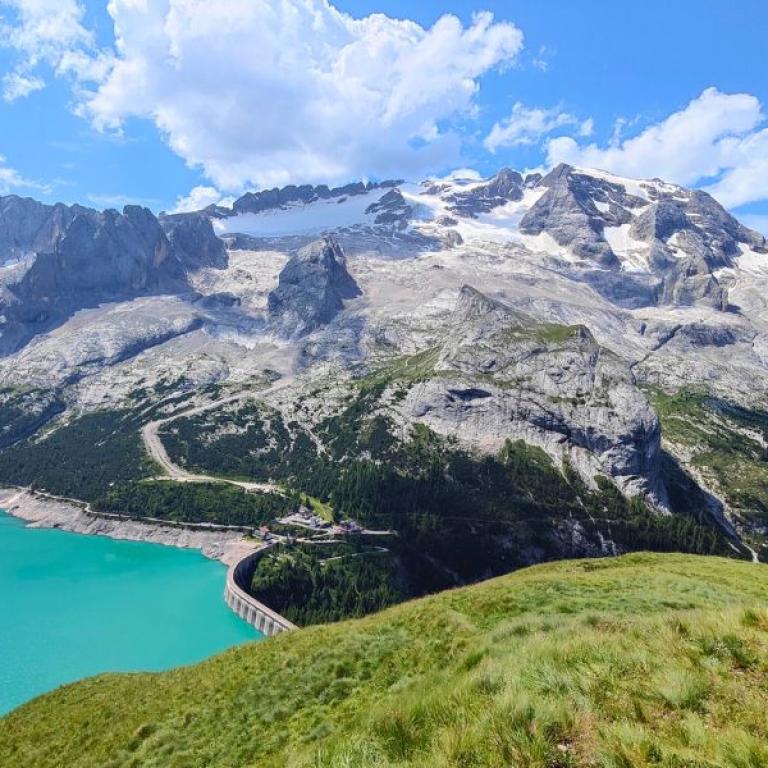
The flat top of the Flat Stone, the panoramic Path of Bread, and the magnificent view of the glacier Marmolada: a pilgrimage in search of the most impressive beauty, among rock giants and every shade of green.
Highlights

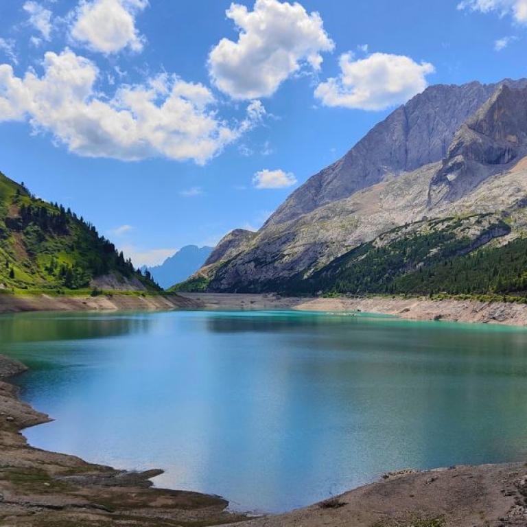
  • Walk through spellbinding views, wild open spaces, mountain lakes, jagged peaks;
  • Enjoy the warm, comfortable family-run accommodation;
  • Observe the rich flora and fauna around you;
  • Taste the superb culinary, including delicious cheeses, polenta, mushrooms, speck and outstanding wines;
  • Find the traces of ladine culture in the ancient dolomite villages

Itinerary

Day 1

Arrive in Canazei

Arrive in Canazei

Arrive with public transport or private transfer to Canazei, check-in at the accommodation and enjoy the peaceful atmosphere of the Dolomites.

Day 2

Selection of Walks in Val di Fassa

Selection of Walks in Val di Fassa

Today you can choose one of the following walks.

WALK A: Walk around Sasso Piatto, 16 km

From Col Rodella you will walk over gravel road for a short distance. Soon after you will walk over the panorama track that takes you to the Rif. Sasso Piatto (with wet weather it can be slippery ande very muddy: be careful!). You have wonderful views of the rough rocks of Sasso Piatto. From here you enter the bizar landscape between the two giants Sasso Piatto on your right and the Sasso Lungo on your left. It resembles a lunar landscape. At Rif. Vicenza you go for 550 meters steep down to the valleystation of the Sasso Lungo lift. You could also take the lift down if you are tired or your knees hurt. From here you walk back to the Col Rodella using mostly gravel roads. It is a long but beautifull walk.

Distance: 16 km

Elevation gain: +810/-850 m

WALK B: Grepa Valley Walk, 10 km 

Razing animals, unspoiled nature and tranquility: all this is Val de Grepa, one of the little-known and populated side valleys of Val di Fassa. From the basin of Ciampac (2160 meters), continuing uphill to Pian de Sele (2346 meters), you reach a small plateau from which you can admire the wild Val de Grepa from above. Walking with a view of the marvelous Sassolungo Group, you reach Pian de Poze and then downhill through the beautiful valley surrounded by greenery with its characteristic wooden huts, crossing the pastures of cows and horses that usually inhabit the area during the summer months.

Distance: 10 km

Elevation Gain: +260/-960 m

Day 3

Selection of walks in Val di Fassa

Selection of walks in Val di Fassa

Today you can choose one of the following walks.

WALK A: Catinaccio Walk, 14 km

This ring walk coasts the imposing Catinaccio group: you walk over tracks and gravelroads, passing Malga Vael and Roda di Vael hut before starting to climb up to the Zigolade Pass. You then start your descent, flanking Forcella di Davoi and Cima Catinaccio with their jagged peaks. You pass hut Preuss and Gardeccia, where you may want to stop and reward yourself with a local snack before continuing to your starting point in Catinaccio. 

Distance: 14 km

Elevation gain: +775/-780 m

WALK B: Via del Pan (Marmolada) Walk, 16 km

Today you walk along Via del Pan, the “bread path”, a nice route that runs along the southern side of the crest, offering amazing views of the Marmolada glacier and Sella mountain group.

Distance: 16 km

Elevation Gain: +350/-1230 m

Day 4

From Passo della Sella to Passo Gardena, 13 km

From Passo della Sella to Passo Gardena, 13 km

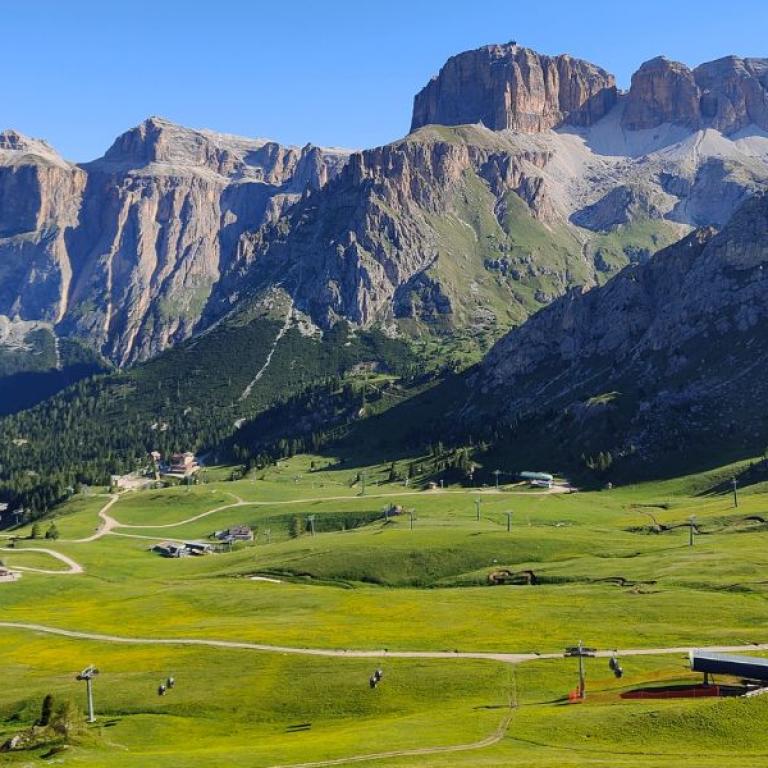
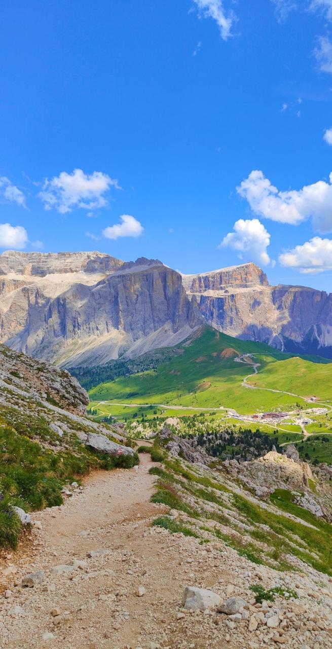
From the Col Rodella you walk over gravelroads and tracks, seeing the steep Sasso Piatto and Sasso Lungo on your left. You come along the Sella Pass and then walk on to the Gruppo del Sella on the right, beautiful and imposing it as it comes closer and closer. The views are stunning in walking direction. Finally you reach Passo Gardena, where your hut is.

Distance: 13 km

Elevation gain: +440/-745 m

Day 5

Corvara Loop Walk, 11 km

Corvara Loop Walk, 11 km

Today you walk on a panoramic loop starting in Corvara, ascending through alpine meadows and larch forests toward the Pralongià plateau, offering sweeping views of the Dolomites. Continue toward Piz Bioch, a perfect spot for a scenic, a perfect spot for a scenic break, before circling back down to Corvara.

Distance: 11 km

Elevation gain: +610/-610 m

Day 6

Selection of walks

Selection of walks

Today you can choose one of the following walks:

WALK A: Bus to Passo Gardena. Walk to Passo Campolungo, 12,5 km

From Gardena Pass the track goes up until you walk pretty much under the Gruppo del Sella. In Val de Mesdi you cross a small river and the path goes down, sometimes quite steep. When you're down in the valley you follow a gravel road until Crep de Sela. From there a steep track takes you finally to Ristorante Boè. From here you take a beautiful track that goes through spectacular rockformations. When you reach the Kaiserhutte you only have to follow the gravel road until you're at the Passo Campolungo.

Distance: 12,5 km

Elevation Gain: +755/-1020 m

WALK B: Bus to Passo Pordoi. Walk to  Passo Campolungo, 10 km

From Pordai Pass a breathtaking high-alpine hike connecting to Passo Campolongo, this route winds through dramatic Dolomite landscapes, passing beneath towering peaks and across rolling meadows. It offers stunning views of the Sella Group and surrounding valleys, blending rugged beauty with serene mountain charm.

Distance: 10 km

Elevation gain: +510/-880 m 

Day 7

Arrivederci, Dolomites!

Arrivederci, Dolomites!

The trip and our services end after breakfast unless you have booked extra services or extra nights. 

Details

Is this for me?


This journey is perfect for you if you love the mountains: compared to other trips, this trip is less strenuous, but it still requires good physical preparation.

This journey is perfect if you love the mountains: it requires a good physical preparation and experience with multi-day hiking; it's a hut-to-hut walking trip, meaning that you won't have the chance to include rest days such as in other trips where loop hikes can be replaced with a day spent relaxing. 

Please note that luggage transfer is only included for some of the days - when heading to and sleeping in the rifugio, you'll need to bring a smaller backpack with everything you need for your stay up there. 

It's not suitable for those who suffer from vertigo or have issues with stability on rocky terrain.

Included


What is included

  • 6 Nights in double room in **/*** hotels
  • 5 breakfasts
  • Luggage transportation from hotel to hotel
  • Maps and detailed description of the itinerary in digital form, app
  • Medical and luggage travel insurance
  • 24h phone assistance

What is not included 

  • Transfers to the starting location and from the arriving location of the tour
  • Lunches and dinners, if not otherwise stated
  • Visits and entrance fees - tips
  • Personal expense
  • Possible sojourn taxes
  • Everything that is not mentioned in the "What is included" section.

Optional Services

These services can be added to the ones included in the base price of the tour:

  • Single room supplement
  • Cancellation insurance
  • Transfers to reach the starting location or to leave the arriving location of the tour, which will be quoted on request.
  • travel documentation in printed form (maps and detailed description of the itinerary), shipped to the first hotel

Accommodation


For our trips, we always choose accommodation with private rooms and private bathrooms. In rare cases, shared accommodations or shared bathrooms may be provided, so we recommend carefully checking the inclusions section to understand the type of accommodation included in the trip you are interested in.  

We place great importance on the choice of accommodations and select hotels with care and attention. We understand how essential it is to rest well after a day of walking. We always prefer cozy and characteristic establishments, preferably family-run, that fully embody the spirit of the place and offer hospitality with courtesy and comfort.  

Where, due to the nature of the route, accommodation options are limited, we choose the one that best aligns with our standards.


Hotel die Arlbergerin ⋆⋆⋆⋆ or similar, Anton am Arlberg

Hotel Haus Flexen ⋆⋆⋆ or similar, Stuben am Arlberg

Hotel Roggal ⋆⋆⋆⋆ or similar, Lech am Arlberg 

Hotel La Campagnola - Canazei
Hotel La Plaza - Corvara


When to travel


In the Dolomites you will experience the typical mountain weather.

In June you will still find patches of snow here and there.

Like in all mountainous areas, the weather can be unpredictable and can change quickly so always check the weather forecast before setting and always take with you a rain jacket, warm hat and gloves.

What to bring


Clothing and other items
You will need your regular walking/cycling gear, including some sort of reflective garment. For the evenings, smart outdoor style trousers (or shorts) are invaluable, as are quick-dry t-shirts. These can be washed easily and will dry overnight and still look good for sightseeing or having a drink in town.

Take as little as possible to avoid potentially lugging a heavy suitcase up three flights of stairs at the end of the day. Please be aware that laundromats (“Laverie”) are not common in rural areas, so plan to do handwashing of small items.

Lightweight walking shoes/ trainers
For wearing around towns & villages. They can also be a back-up pair.

Socks & underwear
Take only good quality socks with quick-dry and insulating qualities. Road test them before you go on the trip. Take a suitable quantity of underwear as washing facilities are limited.

Warm jacket, hat, gloves
Bring a fleece, Polartec or warm layers for the evenings especially in spring or autumn; be sure it is totally suitable for your needs.
A fleece jacket which blocks the wind (Wind-stopper) is the most preferable. In the summer months a lightweight jacket is suitable for evenings.
If you are cycling/walking in mountainous or coastal areas, even in the height of summer, the weather can change very quickly and unexpectedly and you should be prepared for fog, mist, rain, snow or hail at any time. Always take an extra layer with you, as well as a warm hat and gloves.

Waterproof jacket & trousers
If you are caught in heavy rain, with good waterproof clothing you should remain dry. Remember that most garments will lose their properties over time. Few will remain waterproof for more than five years and many deteriorate in three years or less. We recommend a rain jacket with a good hood and collar and waterproof or thermal walking/cycling trousers or tights.

Dress code
In general, you should wear suitable clothing when entering a church (in many places, it is considered unacceptable to go inside wearing shorts or a tank-top). We suggest that women carry a shawl to cover up bear shoulders or low-cut tops. It also comes in handy when your shoulders get sunburned!

It is considered inappropriate for men to go without a shirt / T-shirt (other than at the beach).

Trekking poles (adjustable)
Highly recommended. A pair works best, depending on what you are comfortable with. If you suffer from back or knee pain this should be considered essential. Remember to practise walking with your pole(s) on different types of terrain in the months preceding your trip.

Walking boots
The importance of good footwear cannot be stressed enough. Your boots should be sturdy and of good enough quality to handle all types of terrain. Lightweight boots, (cordura/leather boots) which have Gore-Tex or sympatex water-proofing are most suitable for this trip. They should provide good ankle protection and be well broken in. Waxing leather boots regularly prolongs their life.

Walking tops & trousers
We recommend walking trousers and shorts and quick-dry wicking t-shirts. These can be washed easily and will dry overnight and still look good for sightseeing or having a drink in town. Wicking T-shirts are fast drying, keep moisture away from your skin and are available at outdoor stores. You should also bring one pair of loose-fitting trousers to wear in cities and for evenings out, etc. Shorts or zip-off trousers are useful in warmer weather.

Practical info

How to arrive


From Innsbruck airport (INN) you can either take a bus or a train to the central train station and then a train to Bolzano. From Bolzano take a bus to Canazei, changing in Vigo di Fassa. 

From Verona airport (VRN) you can take a shuttle bus to the central train station and then a train to Ora (Auer). From Ora (Auer) take a bus to Canazei, changing in Cavalese.

Mobile App


Use the SloWays APP for iOS and Android smart phones in combination with the written documentation provided.

The App has the detailed tracks and maps that you can use offline and without roaming. Thanks to the phone’s internal GPS, you can check your exact position on the map, so you always know exactly where you are. It also helps you self-navigate you way while travelling. More information on how to use the App inside the roadbook documents.

The navigation features include:

  • Offline navigation. Mobile data not required after initial download
  • Accurate GPS tracks
  • Autorotation of the maps
  • Daily route summary and elevation chart
  • Panorama of the track and at street level
  • Alarm and vibration that alerts you in case you go off track.
  • Emergency SMS button with position coordinates
  • Possibility to record and take georeferenced photos of problems on route alerting fellow travelers
  • Hotel information
  • Points of interest along the way
  • Historical background

Wanderlust Nominee Best Specialist Tour Operator 2025
Wanderlust
Nominee Best Specialist Tour Operator 2023
Change currency:

We accept:

VISA MASTERCARD

We accept:

VISA
MASTERCARD
FTO ATTA member
100% Green Travelife
ISO Partner ISO Partner
FTO ATTA member 100% Green Travelife ISO Partner ISO Partner

Touroperating
S-Cape Countryside Travels srl
Borgo Allegri 16R
50122 Firenze FI
P. IVA 05227330486

 
© 2025 SloWays. All rights reserved.
Touroperating S-Cape Countryside Travels srl Borgo Allegri 16R 50122 Firenze FI, Italy
VAT Nr 05227330486
extraSmallDevice
smallDevice
mediumDevice
largeDevice
largeDevice
largeDevice