The Wicklow Way Loch

The Wicklow Way

LEVEL
2
DISTANCE
135 km
DURATION
9 days | 8 nights
PERIOD
Mar Apr May Jun Jul Aug Sep Oct
PRICE FROM
€ 1.182
CO2e FOOTPRINT
77 Kg/person
  1. Ireland
  2.  | 
  3. Hiking Tours
  4.  | 
  5. Tourcode IRL03

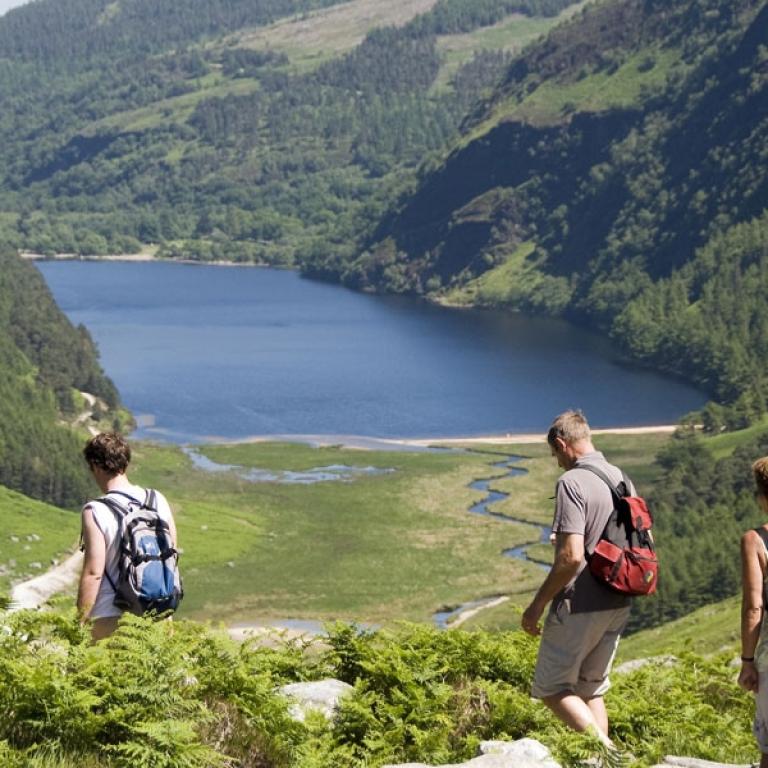
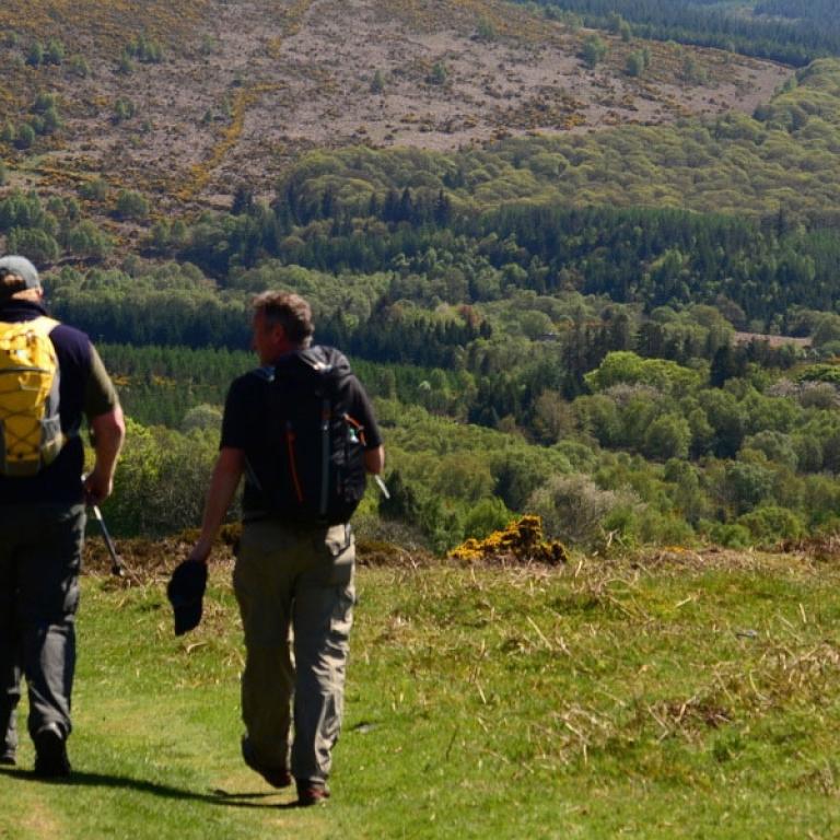
The Wicklow Way is a captivating journey through Ireland's most scenic and tranquil landscapes, often referred to as “The Garden of Ireland”. Starting just outside Dublin, this trail winds through the breathtaking Dublin and Wicklow mountains, offering a perfect mix of rugged beauty and serene countryside. From Rathfarnham to the charming village of Clonegal, the trail meanders through a variety of terrain—forest paths, open mountain tracks, and ancient Irish roads known as boreens. With highlights like the stunning Powerscourt Waterfall, the serene Lough Tay, and the ancient monastic site of Glendalough, every step offers a new discovery. This walk is a perfect blend of nature, history, and traditional Irish charm.

Whether you’re hiking through quiet forests, passing shimmering lakes, or traversing mountain paths with sweeping vistas of the Wicklow Mountains, this trail is an unforgettable experience for any outdoor enthusiast. With its blend of natural beauty, historical landmarks, and vibrant local culture, the Wicklow Way is the perfect escape into Ireland’s heartland.

You can specify how many days you'll be walking when making your reservation.  You can add airport transfers, an overnight stay in Dublin, or a rest day along the way; simply let us know and we will gladly quote you a price and make the necessary arrangements. 
 

Highlights

  • Breathtaking views of Ireland's highest waterfall, Powerscourt, nestled in the Dargle River Valley;
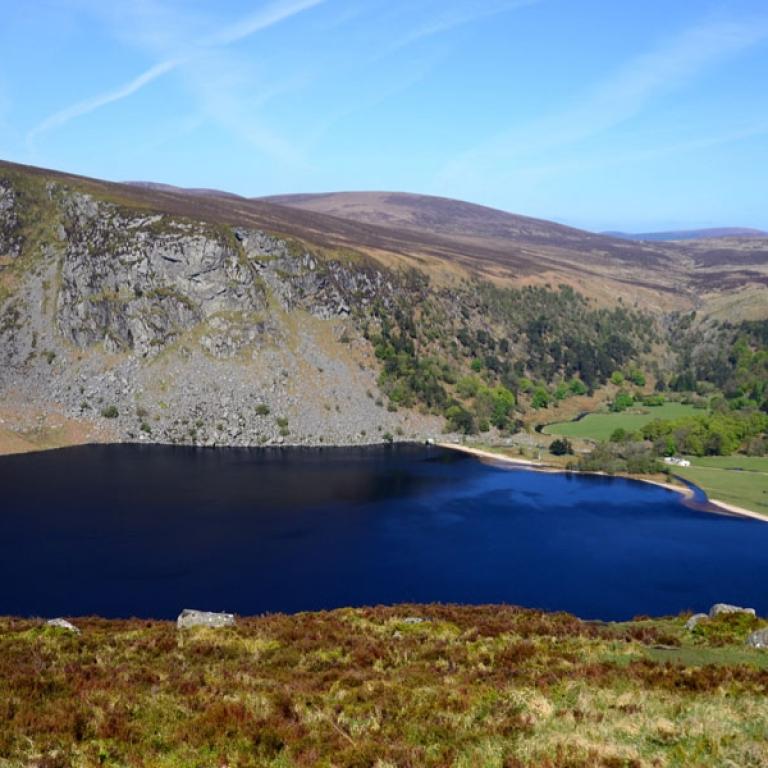
  • The iconic Lough Tay, a striking glacial lake;
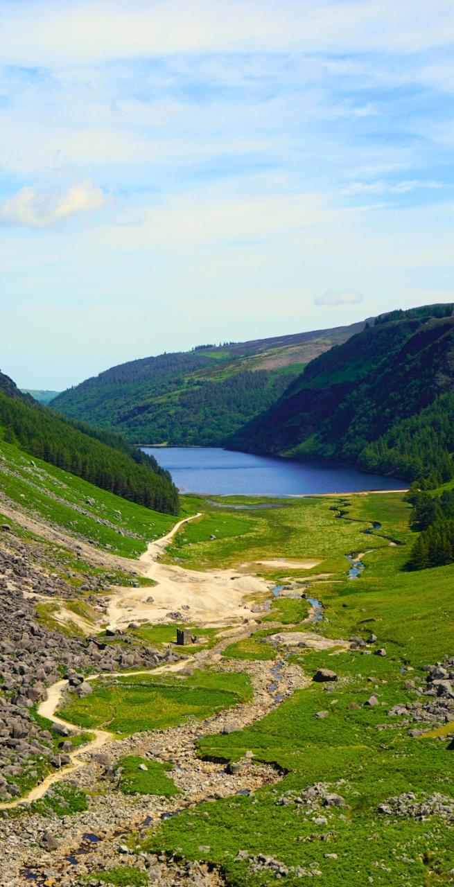
  • Glendalough, renowned for its stunning glacial U-shaped valley, for its monastic site of St. Kevin, founded in the 6th century and the remarkable 100ft round tower;
  • Traditional Irish boreens, or narrow country roads, quiet lanes, often lined with wildflowers during the summer months, offer a serene and picturesque walking experience, immersing you in the rural beauty of Ireland;
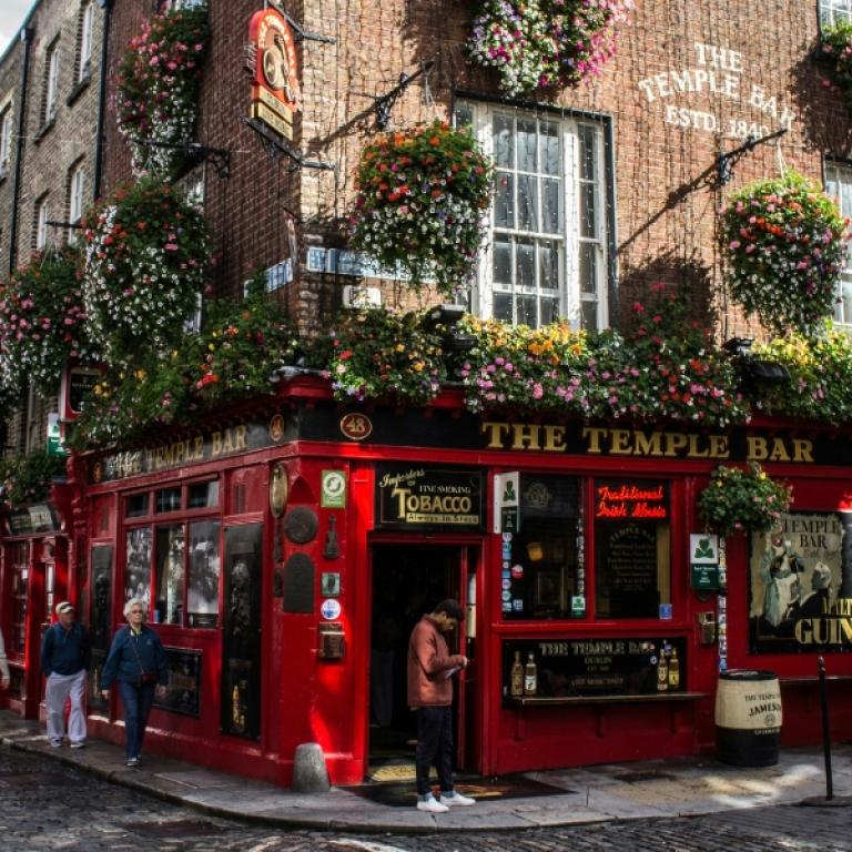
  • Osbourne’s Pub, famous for its historic coffin-lid counter, is the perfect way to celebrate completing the trail.

Itinerary

Day 1

Dublin to Coolakay, 23,3 km

Dublin to Coolakay, 23,3 km

Marlay Park is situated on the south side of Dublin in Rathfarnham, approximately 4km from the city centre. From Marlay Park, you will follow the Wicklow Way trail through the park and out the back.The Wicklow Way travels along the base of Kilmashogue Forest towards Two Rock Mountain, named after the granite tors that sit atop it. Keep following the trail down the side of Tibradden and onto the road towards Glencullen. The stage concludes at Coolakay, a picturesque farm known for its scenic views and welcoming atmosphere, offering a perfect spot to rest and take in the beauty of the surrounding Wicklow countryside.

Distance: 23,3 km

Elevation Gain: +404 m

Day 2

Coolakay to Old Bridge, 16,9 km

Coolakay to Old Bridge, 16,9 km

Continue on the Wicklow Way trail towards Crone Wood. Follow the well-marked path through the forest, which eventually opens up along the edge of a cliff, offering breathtaking views of Powerscourt Waterfall, part of the Dargle River. The trail then leads through a deforested area managed by Coillte, the Irish Forestry Board. For those seeking an additional challenge, there is the option to climb Djouce and rejoin the Wicklow Way after descending. As the trail leads south, a boardwalk guides you over boggy terrain, offering views of Luggala and the stunning Lough Tay in the distance. This is a perfect spot to pause for lunch and enjoy the dramatic landscape. As you descend from White Hill, you will pass a commemorative plaque honoring J.B. Malone, the founder of the Wicklow Way. Continue along the trail until you reach the R759 road, where you can enjoy views of the Guinness Estate and Lough Tay. From here, a transfer take you to your accommodation.

Distance: 16,9 km

Elevation Gain: +502 m

Day 3

Old Bridge to Laragh (Glendalough), 7,2 km

Old Bridge to Laragh (Glendalough), 7,2 km

Glendalough, one of the most visited areas in County Wicklow, is renowned for its stunning glacial U-shaped valley and rich historical significance. The monastic site of St. Kevin, founded in the 6th century, features a remarkable 100ft round tower and is a must-see while visiting. Exploring this area can easily fill an extra day, with numerous scenic walks, including a visit to the beautiful Poolanass Waterfall near the Upper Lake.

Distance: 7,2 km

Elevation Gain: +240 m

Day 4

Laragh (Glendalough) to Glenmalure, 15,6 km

Laragh (Glendalough) to Glenmalure, 15,6 km

Today you pass through the monastic site and cross the Avonbeg River before climbing alongside Mullacore and Lugduff, offering breathtaking views of the Glenmalure Valley and Lugnaquilla, Wicklow’s highest peak. The trail descends in a zig-zag pattern through forested paths, eventually leading to the Drumgoff Crossroads. 

Distance: 15,6 km

Elevation Gain: +432 m

Day 5

Glenmalure to Iron Bridge (Aughrim), 11,9 km

Glenmalure to Iron Bridge (Aughrim), 11,9 km

From Glenmalure, the Wicklow Way follows the historic Military Road, crossing the Avonbeg River and passing the ruins of the Drumgoff Barracks, a reminder of the British military presence in the early 1800s. The trail leaves the road and takes you along a peaceful, forested path on the side of Slieve Maan (Middle Mountain). You’ll soon reach the halfway point marked by a sign as you enter the dense woodland. The path runs parallel to the Military Road before crossing the Aghavannagh River, continuing along Carrickashane Mountain, and eventually reaching Iron Bridge, which crosses the River Ow.

Distance: 11,9 km

Elevation Gain: +398 m

Day 6

Iron Bridge (Aughrim) to Tinahealy, 21,9 km

Iron Bridge (Aughrim) to Tinahealy, 21,9 km

Follow quiet roads and charming boreens, offering pleasant walks especially in summer when the paths are lined with vibrant wildflowers. Despite the peaceful setting, it's important to stay alert and walk on the right side, facing oncoming traffic. Heading south from Moyne, a scenic lane leads to Sandyford Bridge, where you can stop by the nearby St. Colmcille's Holy Well for a quick visit. You'll then arrive to Tinahely, nestled in the Derry River Valley. Tinahely offers opportunities for exploring, like a walk along the old railway line or a visit to Tomnafinnoge Wood, one of Ireland's largest oak forests

Distance: 21,9 km

Elevation Gain: +303 m

Day 7

Tinahealy to Shillelagh, 17,2 km

Tinahealy to Shillelagh, 17,2 km

Today you start walking along the road that leads you over a small bridge and towards Stranakelly Crossroads. Here, a stop at the famous “Dying Cow” Pub is highly recommended for a refreshing break. With a cozy atmosphere and a relaxing beer garden, it's a perfect spot for a bite to eat. Keep following the Wicklow Way uphill, passing along the northern side of Cronelea Hill. From here, follow the minor road into Shillelagh, a charming village with granite-built houses. Shillelagh sits on the Derry River and is known for being the birthplace of the traditional Irish weapon, the Shillelagh, crafted from blackthorn sticks.

Distance: 17,2 km

Elevation Gain: +171 m

Day 8

Shillelagh to Clonegal, 20,9 km

Shillelagh to Clonegal, 20,9 km

Continue through the scenic countryside as you head towards Ballard Crossroads and enter the woods at Raheenakit. The trail meanders through Barnamuinga and Aghowie Upper, offering stunning views over counties Carlow and Wexford. From Wicklow Bridge, the final stretch leads 3km south to Clonegal, where the Wicklow Way concludes, marked by an information board and stone bench. A well-deserved stop at Osbourne’s Pub, famous for its historic coffin-lid counter, is the perfect way to celebrate completing the trail. Don't miss picking up your Wicklow Way Certificate here. Adjacent to the charming village is Clonegal Castle, a 17th-century granite structure steeped in history and local legend.

Distance: 20,9 km

Elevation Gain: +317 m

Day 9

Arrivederci, Wicklow Way!

Arrivederci, Wicklow Way!

Our services end after breakfast unless you have booked another service with us.

Details

Included


What is included

  • 8 Nights in double room in Guesthouses and B&B with breakfast;
  • Luggage transportation from hotel to hotel (max 1 item per person);
  • Transfers as per programme;
  • Maps and detailed description of the itinerary in digital form, App;
  • Medical and luggage travel insurance;
  • 24h phone assistance.

What is not included 

  • Transfers to the starting location and from the arriving location of the tour;
  • Lunches and dinners, if not otherwise stated;
  • Visits and entrance fees - tips;
  • Personal expense;
  • Possible sojourn taxes;
  • Everything that is not mentioned in the "What is included" section.

Optional Services

These services can be added to the ones included in the base price of the tour:

  • Single room supplement;
  • Cancellation insurance;
  • Rest days along the way;
  • Extra nights in Dublin before and after you walk;
  • Transfers to reach the starting location or to leave the arriving location of the tour, which will be quoted on request.

Accommodation


For our trips, we always choose accommodation with private rooms and private bathrooms. In rare cases, shared accommodations or shared bathrooms may be provided, so we recommend carefully checking the inclusions section to understand the type of accommodation included in the trip you are interested in.  

We place great importance on the choice of accommodations and select hotels with care and attention. We understand how essential it is to rest well after a day of walking. We always prefer cozy and characteristic establishments, preferably family-run, that fully embody the spirit of the place and offer hospitality with courtesy and comfort.  

Where, due to the nature of the route, accommodation options are limited, we choose the one that best aligns with our standards.

What to bring


Clothing and other items
You will need your regular walking/cycling gear, including some sort of reflective garment. For the evenings, smart outdoor style trousers (or shorts) are invaluable, as are quick-dry t-shirts. These can be washed easily and will dry overnight and still look good for sightseeing or having a drink in town.

Take as little as possible to avoid potentially lugging a heavy suitcase up three flights of stairs at the end of the day. Please be aware that laundromats (“Laverie”) are not common in rural areas, so plan to do handwashing of small items.

Lightweight walking shoes/ trainers
For wearing around towns & villages. They can also be a back-up pair.

Socks & underwear
Take only good quality socks with quick-dry and insulating qualities. Road test them before you go on the trip. Take a suitable quantity of underwear as washing facilities are limited.

Warm jacket, hat, gloves
Bring a fleece, Polartec or warm layers for the evenings especially in spring or autumn; be sure it is totally suitable for your needs.
A fleece jacket which blocks the wind (Wind-stopper) is the most preferable. In the summer months a lightweight jacket is suitable for evenings.
If you are cycling/walking in mountainous or coastal areas, even in the height of summer, the weather can change very quickly and unexpectedly and you should be prepared for fog, mist, rain, snow or hail at any time. Always take an extra layer with you, as well as a warm hat and gloves.

Waterproof jacket & trousers
If you are caught in heavy rain, with good waterproof clothing you should remain dry. Remember that most garments will lose their properties over time. Few will remain waterproof for more than five years and many deteriorate in three years or less. We recommend a rain jacket with a good hood and collar and waterproof or thermal walking/cycling trousers or tights.

Dress code
In general, you should wear suitable clothing when entering a church (in many places, it is considered unacceptable to go inside wearing shorts or a tank-top). We suggest that women carry a shawl to cover up bear shoulders or low-cut tops. It also comes in handy when your shoulders get sunburned!

It is considered inappropriate for men to go without a shirt / T-shirt (other than at the beach).

Trekking poles (adjustable)
Highly recommended. A pair works best, depending on what you are comfortable with. If you suffer from back or knee pain this should be considered essential. Remember to practise walking with your pole(s) on different types of terrain in the months preceding your trip.

Walking boots
The importance of good footwear cannot be stressed enough. Your boots should be sturdy and of good enough quality to handle all types of terrain. Lightweight boots, (cordura/leather boots) which have Gore-Tex or sympatex water-proofing are most suitable for this trip. They should provide good ankle protection and be well broken in. Waxing leather boots regularly prolongs their life.

Walking tops & trousers
We recommend walking trousers and shorts and quick-dry wicking t-shirts. These can be washed easily and will dry overnight and still look good for sightseeing or having a drink in town. Wicking T-shirts are fast drying, keep moisture away from your skin and are available at outdoor stores. You should also bring one pair of loose-fitting trousers to wear in cities and for evenings out, etc. Shorts or zip-off trousers are useful in warmer weather.

Practical info

How to arrive


On Arrival:    
The closest airport is in Dublin.

On Departure:
From Bunclody take the local bus to Dublin (sometimes you have to change).

Mobile App


Use the SloWays APP for iOS and Android smart phones in combination with the written documentation provided.

The App has the detailed tracks and maps that you can use offline and without roaming. Thanks to the phone’s internal GPS, you can check your exact position on the map, so you always know exactly where you are. It also helps you self-navigate you way while travelling. More information on how to use the App inside the roadbook documents.

The navigation features include:

  • Offline navigation. Mobile data not required after initial download
  • Accurate GPS tracks
  • Autorotation of the maps
  • Daily route summary and elevation chart
  • Panorama of the track and at street level
  • Alarm and vibration that alerts you in case you go off track.
  • Emergency SMS button with position coordinates
  • Possibility to record and take georeferenced photos of problems on route alerting fellow travelers
  • Hotel information
  • Points of interest along the way
  • Historical background

You may also like:


Wanderlust Nominee Best Specialist Tour Operator 2023
Wanderlust
Nominee Best Specialist Tour Operator 2023
Change currency:

We accept:

VISA MASTERCARD

We accept:

VISA
MASTERCARD
FTO ATTA member
100% Green Travelife
ISO Partner
FTO ATTA member 100% Green Travelife ISO Partner

Touroperating
S-Cape Countryside Travels srl
Borgo Allegri 16R
50122 Firenze FI
P. IVA 05227330486

 
© 2025 SloWays. All rights reserved.
Touroperating S-Cape Countryside Travels srl Borgo Allegri 16R 50122 Firenze FI, Italy
VAT Nr 05227330486
extraSmallDevice
smallDevice
mediumDevice
largeDevice
largeDevice
largeDevice