sloWays srl - Email: info@sloways.eu - Telephone +39 055 2340736 - WWW.SLOWAYS.EU
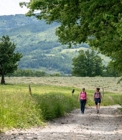
This shorter version of Via degli Dei (5 days) will take you from Sasso Marconi to San Piero.
It is a selection of the most pictoresque stages of the walk, that skips the exit from Bologna through its outskirts and the last section to Florence. It instead crosses the Appennini mountains, an area of wild natural beauty and quiet, with a rich history that dates back to Roman and Etruscan civilization, theatre of violent battles and archaic legends...
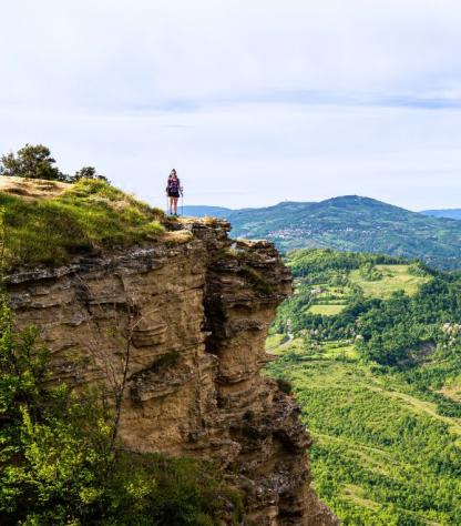
You will be charmed by the wonders of nature along the route: from the Contrafforte Pliocenico, to series of rocky sandstone crags that dominate the Reno valley, with huge beechwoods in the highest part of the walk, as far as the gentle hills of the piana del Mugello: a surprising variety of natural environments, that allows great biodiversity.
Day 1 | Arrival in Sasso Marconi | |
Your travel starts in Sasso Marconi, town named in honour of the Nobel Prize winning scientist Guglielmo Marconi, who was born here in 1874 and who invented the telephone. Before starting to walk, take some time to visit the museum and the Villa Marconi to know more about the genius and his works. |
Day 2 | From Badolo to Monzuno, 16 km | |
A transfer will take you to Badolo, where your adventure will start. Today's walk is characterised by the Contrafforte Pliocenico, a mejestic rocky massif that emerged during the Pliocene age (2-4 million years ago). The path is partly on sandy ground, and it takes you to the edge of the abyss, before reaching the top of Mount Adone and its peculiar stone towers. You will then reach Monzuno: take some time to visit the famous Zanieri charcuterie, renowned for its meat (a Slow Food-recognised speciality). (It is possible to use a bus from Bettola Chiesa to Monzuno, this cuts 5 kms from the total length.) Distance: 16 km Elevation gain: +696/-497 m |
Day 3 | From Monzuno to Bruscoli, 19 km | |
The second day will take you on the stones of the “Flaminia Militare”, the ancient Roman road that used to link Bologna to Arezzo. At Pian di Balestra you will cross the border between Emilia and Tuscany. Your walk ends in Bruscoli where you will spend the night in a charming Agriturismo. Distance: 19 km Elevation gain: +971/-575 m |
Day 4 | From Bruscoli to San Piero a Sieve, 21/28 km | |
In the thirs and last day, you will encounter the Passo della Futa, held by the Germans in the Second World War. We recommend you visit the military cemetery, indeed a moving monument to the absurdity of all wars. The highest peak of the walk is Monte Gazzaro: from its white cross you will be able to have a wide, spectacular view of the Mugello valley. A nice, wide downhill path will bring you to Sant’Agata, a traditional Tuscan village. If you love unusual museums, you should visit the “Museo del Leprino”. From here, the landscape and the villages gradually acquire a more tipically Tuscan appearance. At the end of the walk, you reach San Piero a Sieve: celebrate the end of your tour by trying the robust local cuisine of Mugello, or enjoying the typical Ramerino bread. (Optional transfer: form Sant'Agata take the bus to San Piero a Sieve to shorten the itinerary) Distance: 21/28 km Elevation gain: +676/-1465 m |
Day 5 | Goodbye San Piero! | |
Our services end after breakfast, unless you have booked any extra nights. Have a safe trip back home! |
Thanks to our special APP, you will be able to follow the track of the whole trip on your mobile phone, with no need for internet. GPS tracks are available on request.
Optional Services
These services can be added to the ones included in the base price of the tour: