lys way header
lys way header

The Lys Way, to Monte Rosa

Level
3
Distance
83 km
Duration
8 days | 7 nights
period
Jun Jul Aug Sep
price from
€ 1.154
CO2 footprint
97 Kg/person
  1. Italy
  2.  | 
  3. Self-Guided
  4.  | 
  5. Tourcode ITSW430

The Lys Valley - named after the river that runs through it - is the longest in the Aosta Valley.

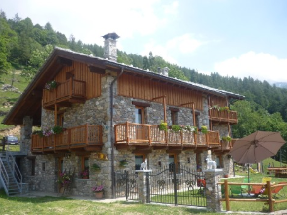
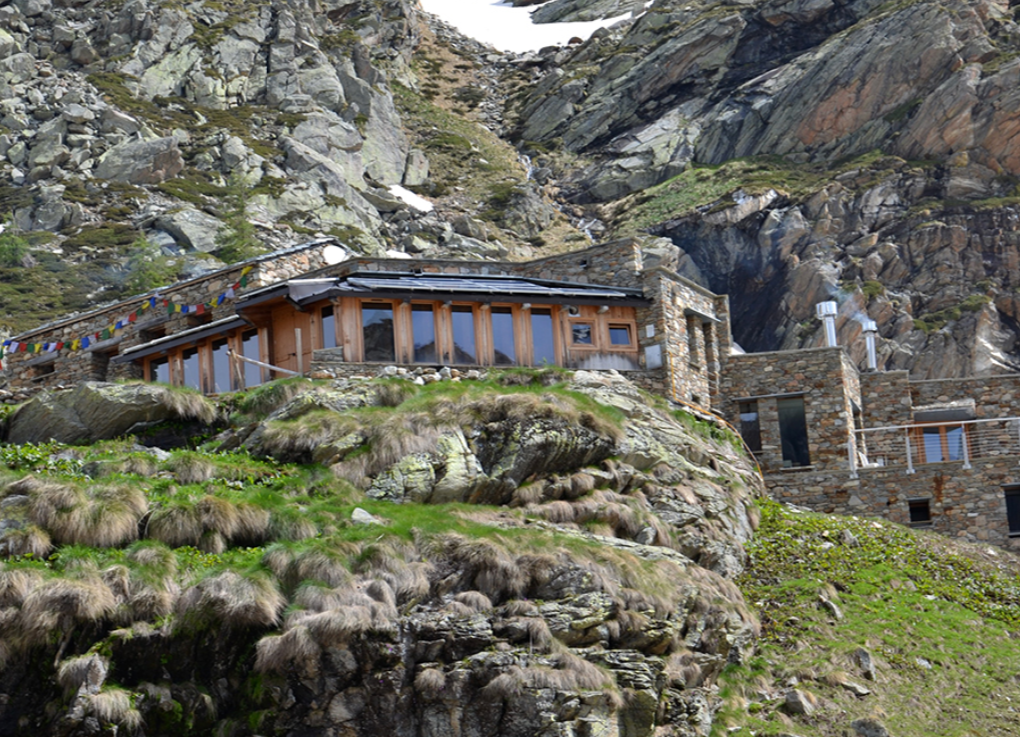
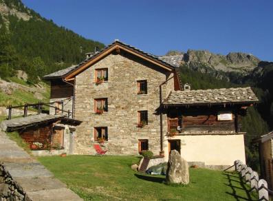
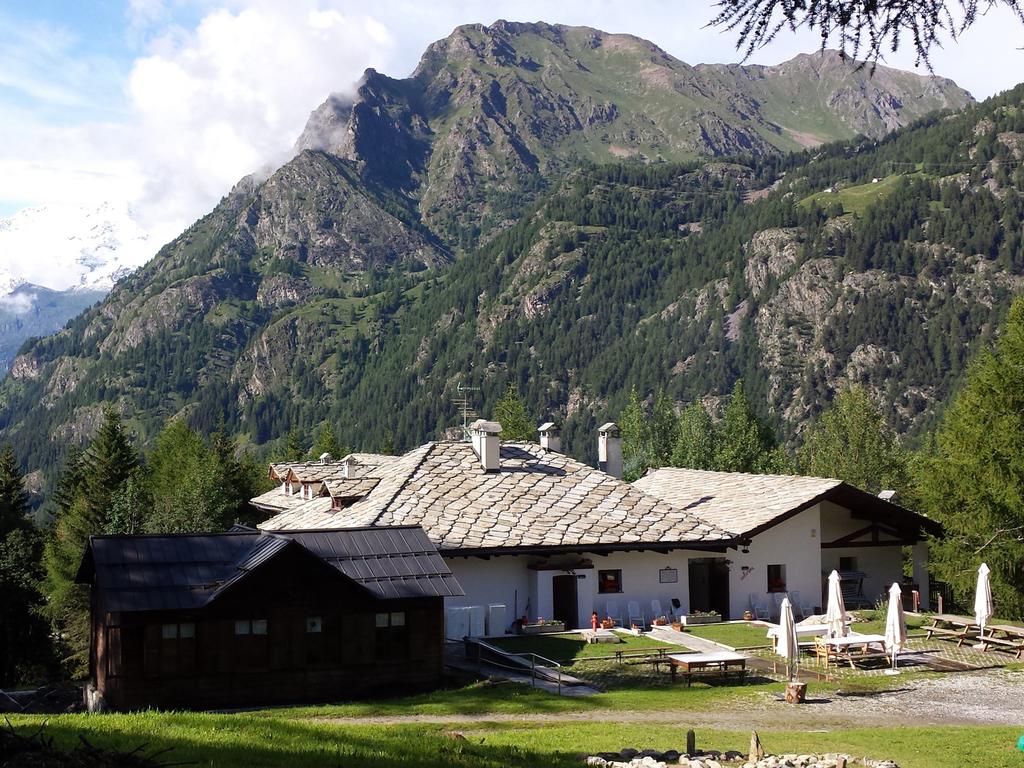
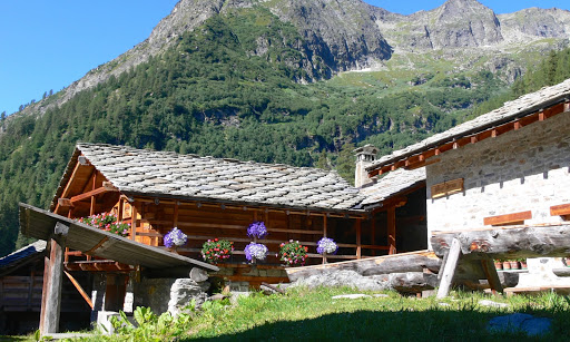
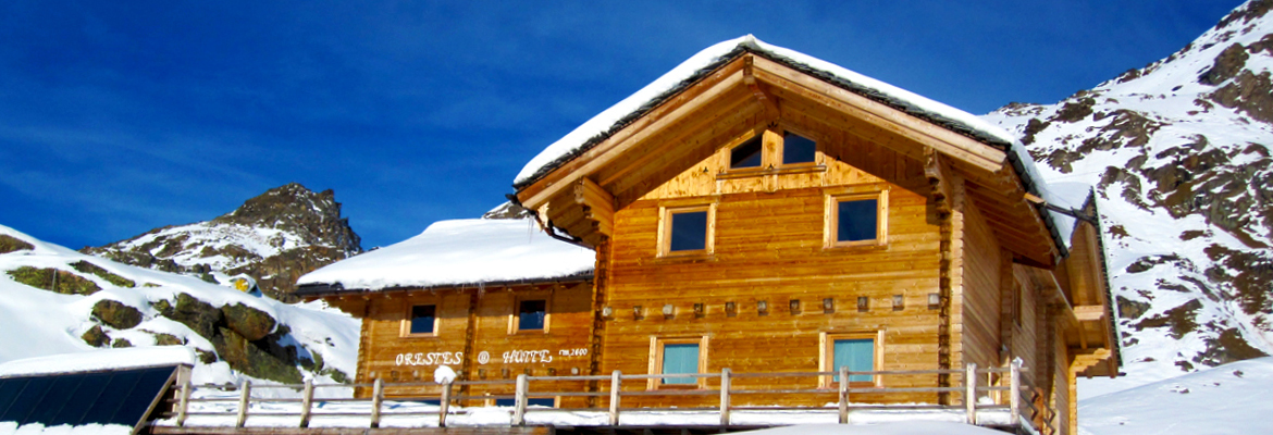
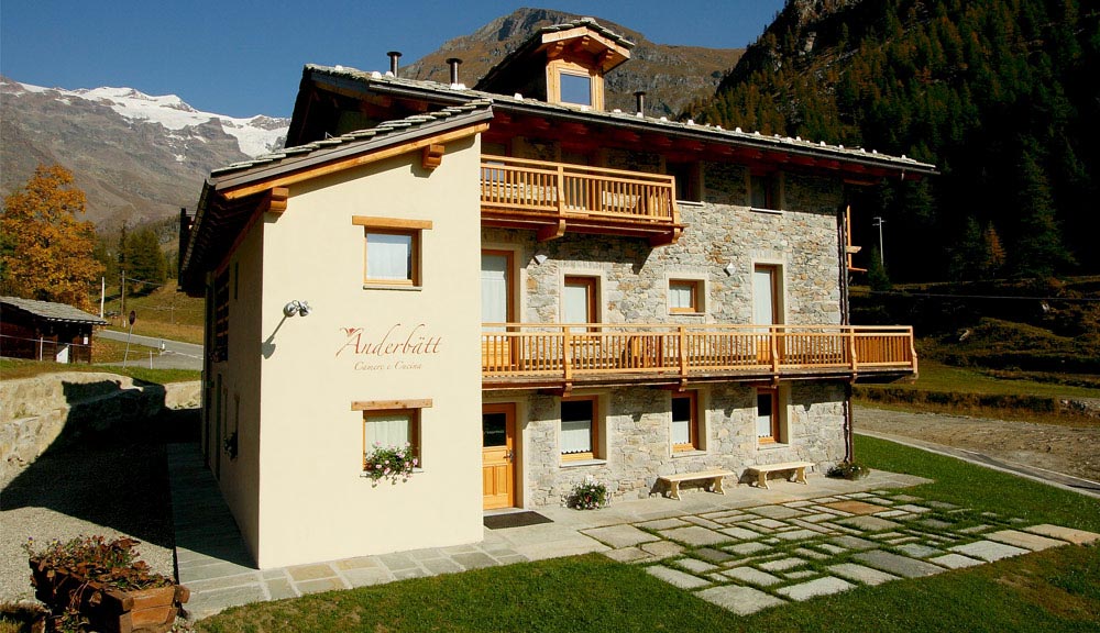
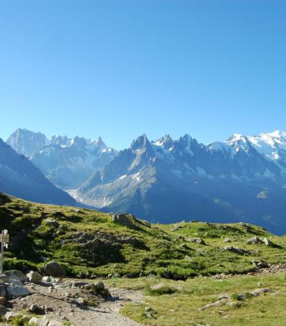
Exploring it to the north means discovering enchanted places and ancient villages in the splendid backdrop of Monte Rosa: from the terraces of Fontainemore to the Monte Mars Natural Reserve - here, everything speaks of wild nature and the influence of the Walser, a population of Germanic origin that arrived in this area more than eight centuries ago.

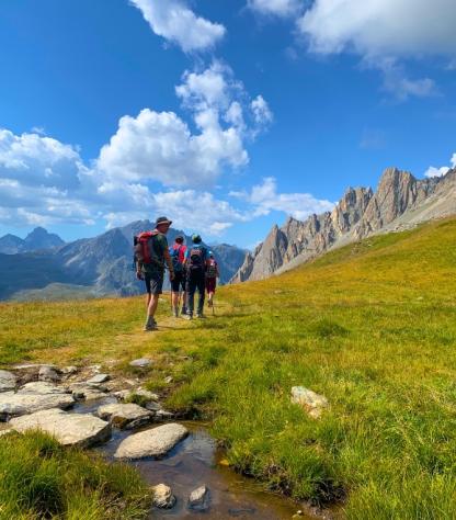
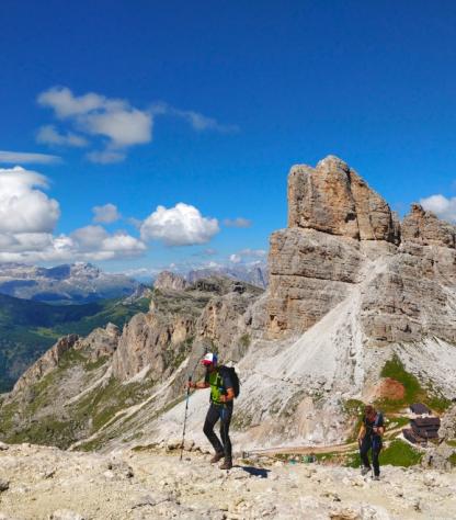
It's a beautiful tour, perfect for discovering the soul of Monte Rosa and for those who love and know the mountains.

Highlights

  • Observe the enviable natural heritage, wild open spaces, beautiful forests, snowy peaks of Monte Rosa;
  • Explore the many little mountain villages to discover, “Walser” heritage, dialect and architecture
  • Appreciate the the many surprises for lovers of history and art, like social wood oven in the villages;
  • Relax in warm, very comfortable and high-standard family-run accommodation.

Itinerary

Day 1

Arrive in Fontainemore

Arrive in Fontainemore

Here in Fontainemore, a short driving distance from Pont Saint Martin, you can park your car in the public car park or, if you came by train, a transfer will pick you up at Pont Saint Martin train station to take you to the Agriturismo Le Soleil: here you can start enjoying the Lys valley crispy air and wander around the forest or just relax at the Agriturismo, where the locally made goat cheese is ready for you to taste.

Day 2

From Le Soleil to La Barma Hut, 8,5 km

From Le Soleil to La Barma Hut, 8,5 km

After breakfast, get ready for the 1st mountain walk of this trip, leading to the Mars mountain - separating Piedmont (East) from the Aosta Valley (West). Remember to bring a change of “confy” clothes and your belongings, since luggage transport is not possible today and you will find your suitcase tomorrow.

The route starts ascending through the forest and fields, before immersing in the wilderness of mountain lakes and peaks; try to spot the mountain hut in the granite valley! If you have some energy left and you want to walk more in the afternoon, your Rifugista will explain the several options available.

Distance: 8,5 km

Elevation gain: +939/-280 m

Day 3

From La Barma Hut to La Gruba, 16,5 km

From La Barma Hut to La Gruba, 16,5 km

If sunset is magic, sunrise is even more colorful here…if you are up this early it means you want to walk the long and wild option through the mountains towards Colle della Vecchia: it’s an adventurous and long hike, so be prepared to spend all day climbing up and down the valleys; if you want to take it easy but still have a nice walk in the nature you can opt to traverse and descend to Issime, passing by the numerous little hamlets with typical mountain architecture. From Issime a short transfer takes you to the accommodation.

Distance: 16,5 km

Elevation gain: +1138/-1556 m

Day 4

From La Gruba to Cialvrina, 14 km

From La Gruba to Cialvrina, 14 km

Today the Vallone del Loo is waiting for you: a gradual and long valley walk, scattered with typical stone houses used to keep the animals but also to host the walkers that venture into this beautiful place. Peaceful and quiet you will descend for the 1st time into the Gressoney valley and then climb onto the other side (transfer available) to the next accommodation, with views of the giant Monte Rosa (rosa=pink, for the colour of its granite stone).

Distance: 14 km

Elevation gain: +1149/-1083 m

Day 5

From Cialvrina to Alpenzu Hut, 11 km

From Cialvrina to Alpenzu Hut, 11 km

This is also called "the Monte Rosa stage", since the Rosa mountain will be guiding us, like the polar star. You pass through many “alpeggi”, where cows and sheep spend the summer and meet the shepherd. The Walser culture is especially present in this area: a German nomadic population, they have been living here since the Middle Ages thanks to their ability to farm at altitude; here the architecture and even the dialect is a mirror of their culture, and one of the best examples is the Alpenzu Hut. Ask to visit the restored social wood oven. Note that today luggage transfer is not available, so pack accordingly.

Distance: 11 km

Elevation gain: +792/-617 m

Day 6

From Alpenzu Hut to Orestes Hut, 14,5 km

From Alpenzu Hut to Orestes Hut, 14,5 km

Today the stage is moderate, and you will reach the Orestes Hut at 2600m. There are 2 options: One is to take the cable car to Gabiet and walk 1.5 hrs to Orestes hut at 2600m, where you will spend the night. The other option is to walk up the hut without taking the cable car, making it a way tougher day. Note that at the hut they only cook tasty vegetarian and vegan food. Luggage transport is also not available, so pack accordingly.

Distance: 14,5 km

Elevation gain: +1400/-600 m

Day 7

From Orestes Hut to Anderbatt, 12 km

From Orestes Hut to Anderbatt, 12 km

Today’s loop walk takes you to the foot of the Pink Giant, Monte Rosa. Here the alpinists start their ascent to the famous Capanna Margherita, named after the queen, at 4500m, or the famous Lyskamm traverse. You will walk up to Colle Salza at 2800m then descend to Staffal/Anderbatt in the Lys valley, with stunning view of the glacier; experienced and fit walkers have the chance to hike to “Alta Luce”, a panoramic point at nearly 3200m.

Distance: 12 km

Elevation gain: +700/-1500 m

Day 8

Goodbye Anderbatt!

Goodbye Anderbatt!

The trip and our services end after breakfast, unless you have pre-booked extra nights with us or other extra services. You can take the public bus/private transfer to Fontainemore where you parked your car.

Details

Is this for me?


Walking at the foot of Monte Rosa and in the Valle del Lys is a delightful experience, but only for those who already have good mountain hiking experience: the daily kilometers are not many, but the elevation gains (over 1000 meters uphill on several days) make this journey very challenging.

The trails often consist of rocks and rather narrow paths, so this route is strongly discouraged for those who do not have full stability and suffer from vertigo. For those with a good level of fitness and a love for the mountains, it is definitely the ideal trip!

Included


What is included

  • 7 Nights in double room with shared bathroom in **/*** mountain huts, B&B and agriturismi with breakfast, packed lunch and dinner
  • luggage transportation (Fontainemore-Gruba, Gruba-Cialvrina, Cialvrina-Anderbatt)
  • transfer Fontainemore-agriturismo Le Soleil
  • maps and detailed description of the itinerary in digital form, app
  • Medical and luggage travel insurance
  • 24h phone assistance

What is not included 

  • Transfers to the starting location and from the arriving location of the tour
  • lunches and dinners, if not otherwise stated
  • visits and entrance fees - tips
  • personal expense
  • possible sojourn taxes
  • everything that is not mentioned in the "What is included" section.

Optional Services

These services can be added to the ones included in the base price of the tour:

  • Single room supplement
  • cancellation insurance
  • Transfers to reach the starting location or to leave the arriving location of the tour, which will be quoted on request.
  • travel documentation in printed form (maps and detailed description of the itinerary), shipped to the first hotel

Accommodation


Fontainemore – Agriturismo le Soleil
La Barma- Rifugio La Barma
La Gruba - Rifugio La Gruba
Cialvrina – Appartamenti Villa Fridau
Alpenzu – Rifugio Alpenzu
Orestes – Rifugio Orestes
Anderbatt – Rifugio Anderbatt

When to travel


In Valle d’Aosta you will experience the typicalmountain weather. In June you will stillfind patches of snow here and there. Like in all mountainous areas, the weather can be unpredictable and can change quickly so always   check the weather forecast  before setting and always take with you a rainjacket, warm hat and gloves.

What to bring


Clothing and other items
You will need your regular walking/cycling gear, including some sort of reflective garment. For the evenings, smart outdoor style trousers (or shorts) are invaluable, as are quick-dry t-shirts. These can be washed easily and will dry overnight and still look good for sightseeing or having a drink in town.

Take as little as possible to avoid potentially lugging a heavy suitcase up three flights of stairs at the end of the day. Please be aware that laundromats (“Laverie”) are not common in rural areas, so plan to do handwashing of small items.

Lightweight walking shoes/ trainers
For wearing around towns & villages. They can also be a back-up pair.

Socks & underwear
Take only good quality socks with quick-dry and insulating qualities. Road test them before you go on the trip. Take a suitable quantity of underwear as washing facilities are limited.

Warm jacket, hat, gloves
Bring a fleece, Polartec or warm layers for the evenings especially in spring or autumn; be sure it is totally suitable for your needs.
A fleece jacket which blocks the wind (Wind-stopper) is the most preferable. In the summer months a lightweight jacket is suitable for evenings.
If you are cycling/walking in mountainous or coastal areas, even in the height of summer, the weather can change very quickly and unexpectedly and you should be prepared for fog, mist, rain, snow or hail at any time. Always take an extra layer with you, as well as a warm hat and gloves.

Waterproof jacket & trousers
If you are caught in heavy rain, with good waterproof clothing you should remain dry. Remember that most garments will lose their properties over time. Few will remain waterproof for more than five years and many deteriorate in three years or less. We recommend a rain jacket with a good hood and collar and waterproof or thermal walking/cycling trousers or tights.

Dress code
In general, you should wear suitable clothing when entering a church (in many places, it is considered unacceptable to go inside wearing shorts or a tank-top). We suggest that women carry a shawl to cover up bear shoulders or low-cut tops. It also comes in handy when your shoulders get sunburned!

It is considered inappropriate for men to go without a shirt / T-shirt (other than at the beach).

Trekking poles (adjustable)
Highly recommended. A pair works best, depending on what you are comfortable with. If you suffer from back or knee pain this should be considered essential. Remember to practise walking with your pole(s) on different types of terrain in the months preceding your trip.

Walking boots
The importance of good footwear cannot be stressed enough. Your boots should be sturdy and of good enough quality to handle all types of terrain. Lightweight boots, (cordura/leather boots) which have Gore-Tex or sympatex water-proofing are most suitable for this trip. They should provide good ankle protection and be well broken in. Waxing leather boots regularly prolongs their life.

Walking tops & trousers
We recommend walking trousers and shorts and quick-dry wicking t-shirts. These can be washed easily and will dry overnight and still look good for sightseeing or having a drink in town. Wicking T-shirts are fast drying, keep moisture away from your skin and are available at outdoor stores. You should also bring one pair of loose-fitting trousers to wear in cities and for evenings out, etc. Shorts or zip-off trousers are useful in warmer weather.

Practical info

Mobile App


Use the SloWays APP for iOS and Android smart phones in combination with the written documentation provided.

The App has the detailed tracks and maps that you can use offline and without roaming. Thanks to the phone’s internal GPS, you can check your exact position on the map, so you always know exactly where you are. It also helps you self-navigate you way while travelling. More information on how to use the App inside the roadbook documents.

The navigation features include:

  • Offline navigation. Mobile data not required after initial download
  • Accurate GPS tracks
  • Autorotation of the maps
  • Daily route summary and elevation chart
  • Panorama of the track and at street level
  • Alarm and vibration that alerts you in case you go off track.
  • Emergency SMS button with position coordinates
  • Possibility to record and take georeferenced photos of problems on route alerting fellow travelers
  • Hotel information
  • Points of interest along the way
  • Historical background

Wanderlust Nominee Best Specialist Tour Operator 2023
Wanderlust
Nominee Best Specialist Tour Operator 2023
Change currency:

We accept:

VISA MASTERCARD

We accept:

VISA
MASTERCARD
FTO ATTA member
100% Green Travelife
FTO ATTA member 100% Green Travelife

Touroperating
S-Cape Countryside Travels srl
Borgo Allegri 16R
50122 Firenze FI
P. IVA 05227330486

 
© 2024 SloWays. All rights reserved.
Touroperating S-Cape Countryside Travels srl Borgo Allegri 16R 50122 Firenze FI, Italy
VAT Nr 05227330486

We and selected third parties use cookies or similar technologies for technical purposes and, with your consent, for functionality and marketing (personalised ads) as specified in the cookie policy. Denying consent may make related features unavailable.

With respect to advertising, we and selected third parties, may use precise geolocation data, and identification through device scanning in order to store and/or access information on a device and process personal data like your usage data for the following advertising purposespersonalised ads and content, ad and content measurement, audience insights and product development.

You can freely give, deny, or withdraw your consent at any time by accessing the preferences panel.


Use the “Accept” button to consent. Use the “Reject” button or close this notice to continue without accepting.

extraSmallDevice
smallDevice
mediumDevice
largeDevice
largeDevice
largeDevice