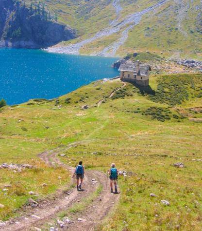
sloWays srl - Email: info@sloways.eu - Telephone +39 055 2340736 - WWW.SLOWAYS.EU
An epic and beautiful journey through Switzerland and towards the green-blue waters of the Great St. Bernard Pass, marking the grand entrance of the Via Francigena into Italy.
The path is equally enchanting - from the Canton of Vaud, with its distinctly French romanticism, medieval villages, and castles, to the shores of Lake Geneva.
But there is more - the terraced vineyards of Lavaux, a UNESCO heritage site, and the Rhone Valley, a paradise for wine lovers - we owe it to the Celts, who first began cultivating wine around 600 BC.
Finally, the Swiss Alps embrace every step of your journey until you reach the Great St. Bernard Pass, where everything ends - and begins again.
Note: due to the weather and altitude, this walk is only possible during the summer months.
Day 1 | Arrive in Sainte-Croix | |
Arriva a Sainte-Croix e raggiungi il tuo hotel. Sainte-Croix è la capitale dei carillon e della musica meccanica. Mentre sei qui, prenditi del tempo per visitare il Museo CIMA (Centre International de la Mécanique d'Art), dedicato alla storia della musica meccanica. |
Day 2 | From Sainte-Croix to Orbe, 18,5 km | |
The Via Francigena reaches Switzerland at La Grand'Borne, near L'Auberson, and leads through the plateaus to Sainte-Croix. You start your walk downhill towards Vuiteboeuf, admiring the views on the way to Orbe, your overnight stop. Distance: 18,5 km Elevation gain: +450/-1080 m |
Day 3 | From Orbe to Cossonay, 26 km | |
On leaving Orbe, follow the path to the medieval town of Romainmôtier. Don't miss the Romanesque church, built between 990 and 1028 in the style of the church of Cluny and considered one of the jewels of the Yverdon-les-Bains region. After this point you continue to what is known as the centre of the world, where one part of the river Nozon flows into the Mediterranean, the other into the North Sea. Distance: 26 km Elevation gain: +630/-555 m |
Day 4 | From Cossonay to Losanna, 26 km | |
Today it is a fairly flat walk along the Venoge River from Cossonay to Saint-Sulpice with its Romanesque church, once the heart of a Cluniac priory, on Lake Geneva (Lac Léman), where it continues along the banks and through the Roman town of Vidy to Lausanne. Until the Reformation in 1536, Lausanne was an important pilgrimage destination and meeting point between the Via Francigena and the Way to Santiago de Compostela. Today it is home to the headquarters of the International Olympic Committee. Take time to explore the hilly old town with its medieval streets lined with shops and Gothic cathedral. Distance: 26 km Elevation gain: +255/-440 m |
Day 5 | From Losanne to Vevey, 21 km | |
The stage with which you will celebrate the start of your journey initially runs along Lake Geneva and through the Lavaux vineyards. This wine-growing area of more than 800 hectares is a UNESCO World Heritage site as a testimony to the passion and hard work required for the perfect integration of human activity and the natural landscape. Take a break from your walk to taste some wine in a wine cellar. Cheers! Distance: 21 km Elevation gain: +455/-455 m |
Day 6 | From Vevey to Aigle, 27 km | |
The route skirts around Lake Leman, crossing Montreux and proceeding until Villeneuve. Leaving the lake behind, the course continues levelly till it arrives at the entrance of Aigle. It then rises to pass Yvorne and a lovely panoramic point of the Rhône Valley, before descending to Aigle. Distance: 27 km Elevation gain: +300/-280 m |
Day 7 | From Aigle to St. Maurice, 19 km | |
Leaving Aigle, the route passes a beautiful area of vineyards as it shortly arrives at the castle, Chateau d’Aigle, home of the wine museum, constructed in the 13th Century. Proceeding through vineyards and woods along the coast, the path reaches Ollon. It leads beyond Antagnes, where the route briefly follows the Gryonne till it arrives at Massongex and Saint Maurice, where since the Middle Ages, pilgrims have paused at on their journey to Rome. Distance: 19 km Elevation gain: +500/-480 m |
Day 8 | From St. Maurice to Martigny, 17 km | |
Just after Saint-Maurice you reach Vérolliez, where a tiny chapel commemorates the martyrdom of St Mauritius and his companions. On the path into the Rhone valley, you meet the famous Pissevache waterfall and the 200-metre-deep Trient gorge. Distance: 17 km Elevation gain: +300/-240 m |
Day 9 | From Martigny to Orsieres, 19 km | |
This stage marks the begin of the climb to the Great St. Bernard pass. From Martigny a steep path leads over the narrow Les Trappistes pass to the medieval village of Sembrancher. From here the route follows the Napoleon trail. In Orsières, don't forget to visit the church, the bell and its "Saint Gregoire Mass" and inside the church, the exhibition about Maurice Tornay, born in Orsières. Distance: 19 km Elevation gain: +745/-335 m |
Day 10 | From Orsieres to Bourg St. Pierre, 15 km | |
This stage leads you first along a forest path, west then east of the river, on the historic path from Liddes to the small Notre-Dame-de-Lorette Chapel before Bourg-Saint-Pierre. Distance: 15 km Elevation gain: +970/-190 m |
Day 11 | From Bourg St Pierre to Col Grand St. Bernard, 12 km | |
Undoubtedly the most symbolic stage on the Via Francigena! The way to the pass leads along a road which has served the whole of Europe for 2000 years. Countless archaeological sites line the ascent, above all in L’Hospitalet and on the Great-St-Bernard Pass. Distance: 29 km Elevation gain: +1045/-305 m |
Thanks to our special APP, you will be able to follow the track of the whole trip on your mobile phone, with no need for internet. GPS tracks are available on request.
What is included
What is not included
Optional Services
These services can be added to the ones included in the base price of the tour: